1
/
of
1
East West Maps
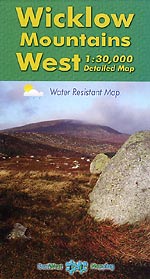
Wicklow Mountains West
Wicklow Mountains West
Regular price
€9.95 EUR
Regular price
Sale price
€9.95 EUR
Taxes included.
Shipping calculated at checkout.
Quantity
Couldn't load pickup availability
For recreational users who visit the Wicklow Mountains for hillwalking- rambling- family walks- cycling- birdwatching- heritage and local history explorations. Covers from Blessington to Laragh and Sally Gap to Glendalough.
From East West Mapping: Definitive detailed map of the central Wicklow Hills. Surveyed extensively on foot and by bike in 2009/10- depicting in detail the network of tracks- paths- forests & hills of interest to walkers etc. Many historical sites are plotted and named. Many placenames recorded on mapping for the first time. Printed on high quality Pretex 120 gsm paper. Water resistant and tear resistant. 1:30-000 Scale : 1 centimetre on the map = 300 metres on the ground. For recreational users who visit the Wicklow Mountains for hillwalking- rambling- family walks- cycling- birdwatching- heritage and local history explorations. Covers from Blessington to Laragh and Sally Gap to Glendalough. Published May 2010.
Share


