East West Maps
Wicklow East
Wicklow East
Couldn't load pickup availability
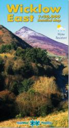
Map covers from Bray to Wicklow town and inland from the coast to Sally Gap. The area is a mixture of urban & rural terrain with a surprising number of recreational opportunities.
From East West Mapping: Definitive detailed map of the coastal strip of east Wicklow. Surveyed extensively on foot and by bike 2009-11- depicting in detail the network of tracks- paths- forests- hills- coast etc. of the region. Map covers from Bray to Wicklow town and inland from the coast to Sally Gap. The area is a mixture of urban & rural terrain with a surprising number of recreational opportunities. Many historical sites are plotted and named - old placenames have been recorded. The contouring is at a 10 metre due to popular demand but being based on the SRTM data- still has limitations in terms of fine detail. That said- it is perfectly functional for everyday use. Printed on high quality Pretex 120 gsm paper. Water resistant and tear resistant. For care instructions see the FAQ section above. 1:30-000 Scale : 1 centimetre on the map = 300 metres on the ground. For recreational users who live in or visit the eastern side of County Wicklow for hillwalking- rambling- family walks- cycling- birdwatching- heritage and local history explorations. Also of considerable use as a general map of the region for all residents. Published March 2011.
Share


